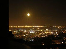
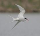
I'll be back in July - just when the fog clears.
Ciao.
Wednesday, May 27, 2009
Off to Italia, but my heart will stay here ...
Tuesday, May 26, 2009
Repeal Prop 8 - Protest March San Francisco (11/7/2008)
State court upheld Prop 8 this morning - legalizing discrimination. Minorities beware. If the majority can strip rights away from one minority - they can do it to another.
The video is from November of last year. But right now, as I type this and look out my window, a helicopter is circling above the Castro. Earlier today the choppers were circling over the Civic Center. Many have taken to the streets today and this evening. The fight is not over.
A brief was filed today with a federal court, asking that Prop 8 be set aside until the court can decide if Prop 8 violates our Federal constitution. Of course it does.
A sad, sad day. But eventually, this too shall pass and marriage equality will prevail.
Pemberton Stairs Revised
(I recently revisited the Pemberton Stairs - and have reposted to include new pics. The gardens are in full bloom right now.)
Walking in San Francisco means walking up and down hills, and up and down public staircases lined with quaint homes and private gardens.
The Pemberton Stairs are on a hillside just north (and a bit west, but not too much) of the Twin Peaks Lookout. The stairs begin at Clayton and climb up past Greystone, past Villa Terrace and end at Crown
Terrace. Turn right at Crown Terrace and head over to Twin Peaks Blvd. Cross that street and you can climb up the stairs to the top of Tank Hill.


.jpg)


Take a look at the broad view from above.
Just a wee bit closer.
Walking in San Francisco means walking up and down hills, and up and down public staircases lined with quaint homes and private gardens.
The Pemberton Stairs are on a hillside just north (and a bit west, but not too much) of the Twin Peaks Lookout. The stairs begin at Clayton and climb up past Greystone, past Villa Terrace and end at Crown
Terrace. Turn right at Crown Terrace and head over to Twin Peaks Blvd. Cross that street and you can climb up the stairs to the top of Tank Hill.


.jpg)


Take a look at the broad view from above.
Just a wee bit closer.
Sunday, May 3, 2009
Tank Hill
Tank Hill is a stone’s throw (ok, well, maybe a javelin or discus throw) away from my place. Actually, it’s not a throw away at all, but a short walk (up the Pemberton Stairs to Crown Terrace – turn right, cross Twin Peaks Blvd and there you are).
I’ve pondered the name for some time. I conjure up images of an old WWI tank – but there were no tanks in the City. Batteries were built along the coast with canon to protect the shore, but tanks? In the City?
Was Tank Hill so-named because its shape was tank-like?
Not at all. Once upon a time, a water tank stood atop the hill. The tank was removed in 1957 and back in the 70s, developers coveted this land and of course, wanted to build upon it, but the neighborhood fought back and convinced the city to purchase the land and keep it as open space. Tank Hill has been open space ever since. Despite all its urban decadence, San Francisco is a city that loves open space and provides plenty of it for her residents.
Tank Hill (presumably from the east side) in days of old.

Tank Hill as seen today from the west side.

Tank Hill is never very crowded – most of the time I walk up there, no one’s about. On occasion, early in the morn, I might find a dog with his 2-foot companion out for a foggy morning walk, or on rare occasions, someone meditating. On one afternoon’s walk, a rapper and his film crew were recording on Tank Hill. He rapped with the wind blowing his hair, the city in the background. Alas, I didn’t stop to inquire, so I am left to wonder – if I watch MTV, will I see this fellow? Was he a professional? Amateur?
But what a grand way to start the day: walk up the Pemberton Stairs and over to Tank Hill for a panoramic view of the City, beginning in the east, looking out and over the bay to Oakland and Alameda, over to downtown, and west, toward the Golden Gate, the ocean itself, and closer, a swatch of Golden Gate Park, Cole Valley and the Haight. Sunsets too are beautiful from Tank Hill. You lean against the rock outcrops (radiolarian chert rock – formed eons ago – 130 million years ago actually, on the ocean floor – and here now, 650 feet above sea level, providing comfy nooks and crannies to sit and lean upon, and gaze out over what to me, is one of the most beautiful cities in the world). Leaning against those rocks on the west side of the hill, you watch the sun slowly settle down into the ocean. And as it slowly sinks down, the sky pinks up, and the houses in Cole Valley are awash in shadow and gold, and the tall buildings downtown glimmer with shades of pink and their windows are set afire from the sun’s last rays. If you’ve any forethought, you’ve brought a bit of wine with you to Tank Hill and you can toast the town and bid the sun a good evening. If you’re very adventuresome, you can climb up Tank Hill in the dark and turn east, to watch the moon rise.
But the pics below were taken on a cool April morning, last week.
Crossing Twin Peaks headed to Tank Hill. That’s Mt. Corona with the City behind it.

A cloudy sunrise from Tank Hill


Mt. Corona from Tank Hill

The church spires of 90 year-old St. Ignatius on the University of San Francisco’s campus. You can just make out the top of the Golden Gate Bridge to the far left.

Looking west, out over Cole Valley and The Haight. The green swath to the left is part of Golden Gate Park and to the right, in the distance, you can just make out the twin spires of St. Ignatius.

A closer (but not very close) look at the Golden Gate Bridge

A broader satellite view of Tank Hill and the surrounding area.
References:
http://www.sfnpc.org/tankhillhistory
http://www.sfgate.com/cgi-bin/article.cgi?f=/c/a/2007/10/25/NSQ6SM9PI.DTL
http://geomaps.wr.usgs.gov/sfgeo/geologic/stories/marin_sedimentary.html
http://seis.natsci.csulb.edu/bperry/Sedimentary%20Rocks%20Tour/chert.htm
I’ve pondered the name for some time. I conjure up images of an old WWI tank – but there were no tanks in the City. Batteries were built along the coast with canon to protect the shore, but tanks? In the City?
Was Tank Hill so-named because its shape was tank-like?
Not at all. Once upon a time, a water tank stood atop the hill. The tank was removed in 1957 and back in the 70s, developers coveted this land and of course, wanted to build upon it, but the neighborhood fought back and convinced the city to purchase the land and keep it as open space. Tank Hill has been open space ever since. Despite all its urban decadence, San Francisco is a city that loves open space and provides plenty of it for her residents.
Tank Hill (presumably from the east side) in days of old.

Tank Hill as seen today from the west side.

Tank Hill is never very crowded – most of the time I walk up there, no one’s about. On occasion, early in the morn, I might find a dog with his 2-foot companion out for a foggy morning walk, or on rare occasions, someone meditating. On one afternoon’s walk, a rapper and his film crew were recording on Tank Hill. He rapped with the wind blowing his hair, the city in the background. Alas, I didn’t stop to inquire, so I am left to wonder – if I watch MTV, will I see this fellow? Was he a professional? Amateur?
But what a grand way to start the day: walk up the Pemberton Stairs and over to Tank Hill for a panoramic view of the City, beginning in the east, looking out and over the bay to Oakland and Alameda, over to downtown, and west, toward the Golden Gate, the ocean itself, and closer, a swatch of Golden Gate Park, Cole Valley and the Haight. Sunsets too are beautiful from Tank Hill. You lean against the rock outcrops (radiolarian chert rock – formed eons ago – 130 million years ago actually, on the ocean floor – and here now, 650 feet above sea level, providing comfy nooks and crannies to sit and lean upon, and gaze out over what to me, is one of the most beautiful cities in the world). Leaning against those rocks on the west side of the hill, you watch the sun slowly settle down into the ocean. And as it slowly sinks down, the sky pinks up, and the houses in Cole Valley are awash in shadow and gold, and the tall buildings downtown glimmer with shades of pink and their windows are set afire from the sun’s last rays. If you’ve any forethought, you’ve brought a bit of wine with you to Tank Hill and you can toast the town and bid the sun a good evening. If you’re very adventuresome, you can climb up Tank Hill in the dark and turn east, to watch the moon rise.
But the pics below were taken on a cool April morning, last week.
Crossing Twin Peaks headed to Tank Hill. That’s Mt. Corona with the City behind it.

A cloudy sunrise from Tank Hill


Mt. Corona from Tank Hill

The church spires of 90 year-old St. Ignatius on the University of San Francisco’s campus. You can just make out the top of the Golden Gate Bridge to the far left.

Looking west, out over Cole Valley and The Haight. The green swath to the left is part of Golden Gate Park and to the right, in the distance, you can just make out the twin spires of St. Ignatius.

A closer (but not very close) look at the Golden Gate Bridge

A broader satellite view of Tank Hill and the surrounding area.
References:
http://www.sfnpc.org/tankhillhistory
http://www.sfgate.com/cgi-bin/article.cgi?f=/c/a/2007/10/25/NSQ6SM9PI.DTL
http://geomaps.wr.usgs.gov/sfgeo/geologic/stories/marin_sedimentary.html
http://seis.natsci.csulb.edu/bperry/Sedimentary%20Rocks%20Tour/chert.htm
Subscribe to:
Comments (Atom)

